

A Tale of Four Constellations
During the 2018-2019 academic year, an Ohio University Electrical Engineering senior design team, under my supervision, created a website to archive the performance of the four global navigation satellite systems (GNSS): the U.S. GPS, the Russian Glonass, the European Galileo and the Chinese Beidou systems. The website is: www.gnssperformancemonitor.com
Four ublox receivers, each configured to track only one of the four constellations, are connected to an antenna mounted on the roof of the Ohio University Russ College of Engineering building (known as Stocker Center) in Athens, Ohio.
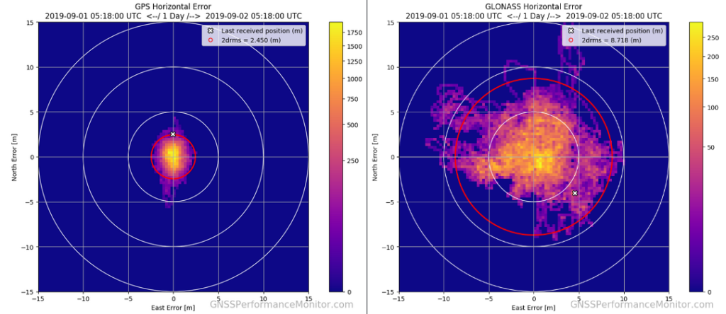
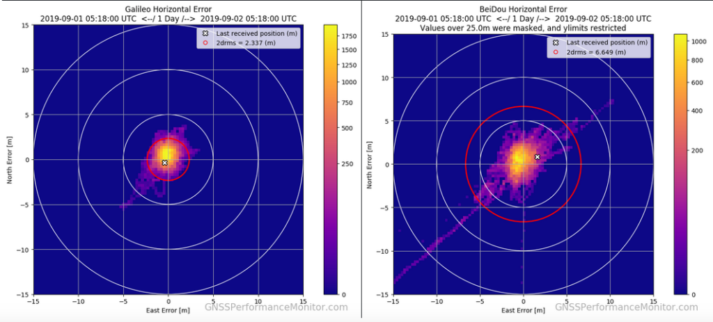
Using the data collected from the four receivers, the website enables users to view horizontal scatter error plots (heat maps) and compare a variety of performance metrics such as horizontal position error, vertical position error and DOPs. Users can view data collected over the past day, week, month, year or the entirety of the data set. Although the website has only been in operation for a few months, some interesting performance characteristics have been noted. As indicated in the plots above, the GPS 2drms error is generally about 2.5 meters. Galileo is typically about 5% better than GPS (notwithstanding the week-long outage that Galileo had back in July of this year). Although Beidou’s performance is typically a factor of three worse than GPS or Galileo, this is explained by the fact that the Beidou constellation is still being deployed and coverage thus far has been concentrated over mainland China. Finally, Glonass is typically a factor of four to five worse than GPS or Galileo and is at least partially due to the FDMA nature of the legacy signals.